00:00 to 00:45 · The question
QuestionCan you trust a map that QGIS says loaded?
Open one London dataset, catch a silent style error, find one insight and export a checked PDF.
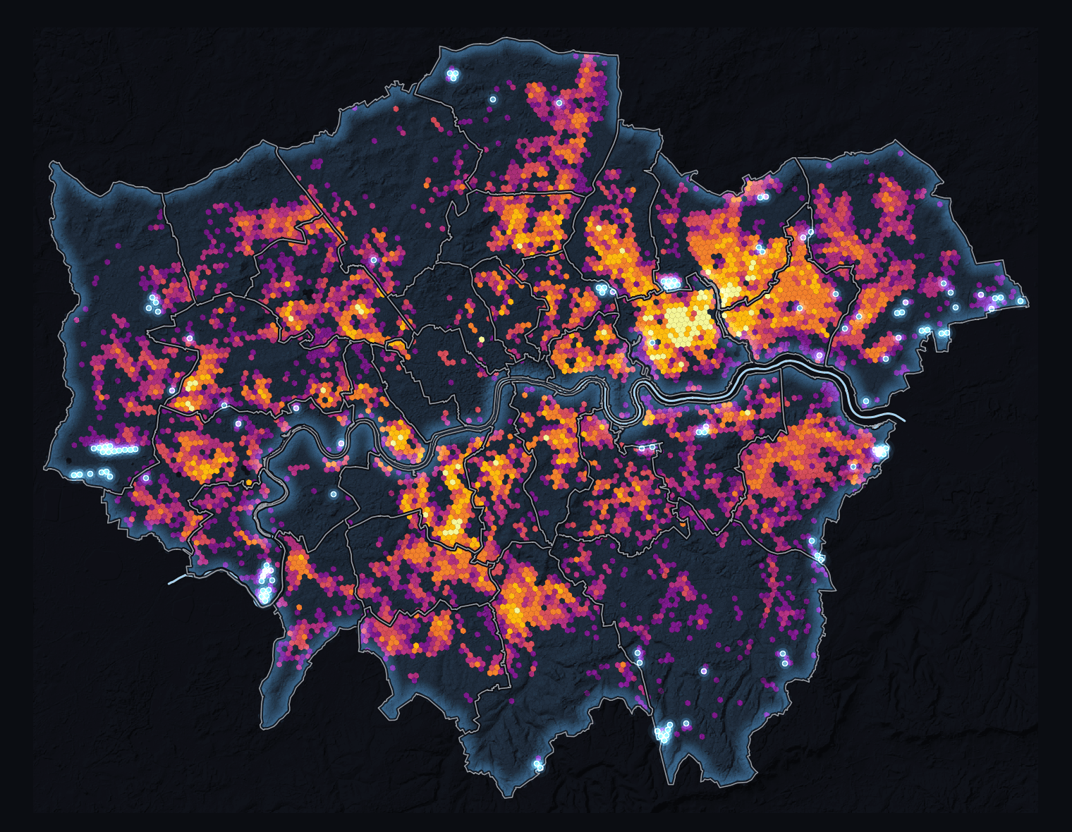
Existing London proof example
Slide 1 of 12: Can you trust a map that QGIS says loaded?
00:00 to 00:45 · The question
QuestionOpen one London dataset, catch a silent style error, find one insight and export a checked PDF.
Existing London proof example
00:45 to 02:30 · Foundations
FoundationPoints locate, lines connect, polygons enclose and rasters form grids. Today we use polygons.
POINT
one place
LINE
a route
POLYGON
an area
RASTER
a grid
02:30 to 05:00 · Open
MethodOpen h3_heat_exposure_r9.parquet. Its source is EPSG:4326; the project displays it in EPSG:27700.
05:00 to 06:30 · Check
CheckedBefore styling, check three things: polygons, 16,659 features and the heat-exposure column.
06:30 to 08:15 · Break
BoundaryThe style requests exposure_pdc. The data provides heat_exposure_pk_per_km2. Result: zero coloured cells.
QML requests
exposure_pdcGeoParquet contains
heat_exposure_
pk_per_km2
0 features classified
08:15 to 10:00 · Stop
BoundaryQGIS loaded the style, but coloured 0 of 16,659 cells. Do not continue.
STOP
zero classified features
A blank map is a failed check.
10:00 to 12:00 · Repair
CheckedUse the fixed style. Now 16,659 cells enter seven classes.
Before
exposure_pdc0
classified
After
heat_exposure_
pk_per_km2
16,659
classified in 7 classes
12:00 to 14:30 · Analyse
MethodSelect the upper map class. The 40,000 cut-off organises the map; it is not a health threshold.
heat_exposure_pk_per_km2 >= 40000Selected
105
Share
0.63%
14:30 to 16:30 · Interpret
CheckedThat is 0.63% of London cells in one 29 July 2026 snapshot. It is not air temperature or individual risk.
105 of 16,659 cells · 29 July 2026
One daytime Landsat 9 scene · modelled population · not individual risk
16:30 to 19:30 · Design
Design1. Claim and map. 2. Legend and scale. 3. Conditions and sources.
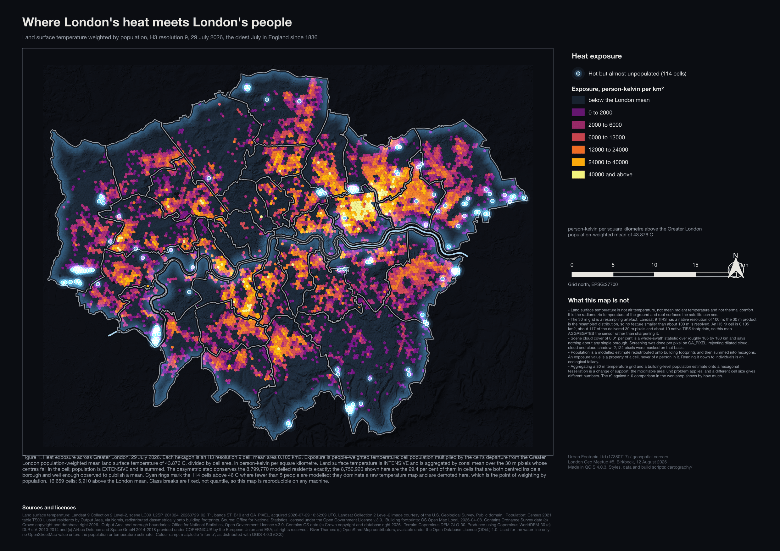
01 claim + map
02 legend + scale
03 conditions + attribution
19:30 to 22:30 · Export
CheckedOpen the PDF outside QGIS. Can you see the map, legend, scale and sources?
FILE
exists and bytes > 0
MAP
visible after reopening
FURNITURE
legend, scale and attribution
22:30 to 30:00 · Transfer and questions
InvitationKeep five checks: load, schema, style, analysis and export. Stop building at 25:00; questions start.
Open workshop pageplace + input
+ visible check
Build stops 25:00 · questions to 30:00
Swipe or use controls · Arrow keys move · Home and End jump